Sr Center Events
Check out some upcoming events with Ben Wilson Sr Activity Center. More information at www.bwsac.org
Check out some upcoming events with Ben Wilson Sr Activity Center. More information at www.bwsac.org
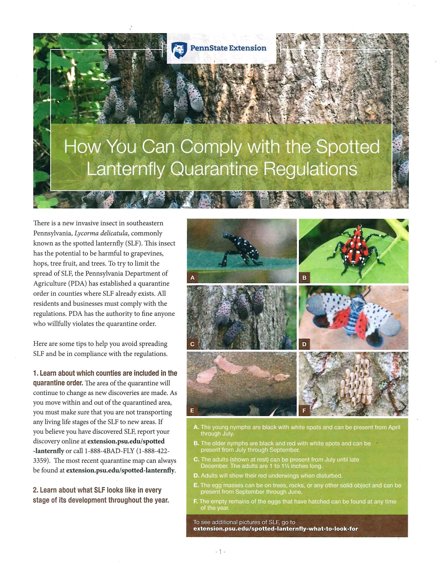
Questions about the Spotted Lanternfly? Please refer to the chart. Residents are encouraged to help combat the spread of the spotted lanternfly by eliminating these non-native insects when possible. At this time of year, both adult spotted lanternflies and their egg masses can be found. Please keep a look out and destroy these invaders whenever possible. Other tips can be found at https://extension.psu.edu/spotted-lanternfly. (pdf version)
The First 275 Years
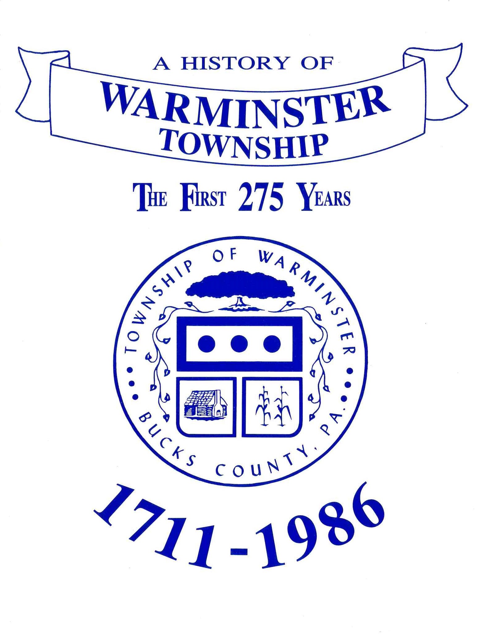
Published by the Warminster TownshipCopyright (c) 1986
275th Anniversary Commission
by authorization of the
Warminster Township Board of Supervisors
Paul C. Bailey, Township Historian, Author
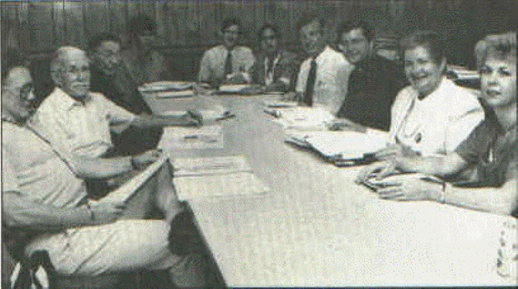 A Working Session of the Commission and Committees'
 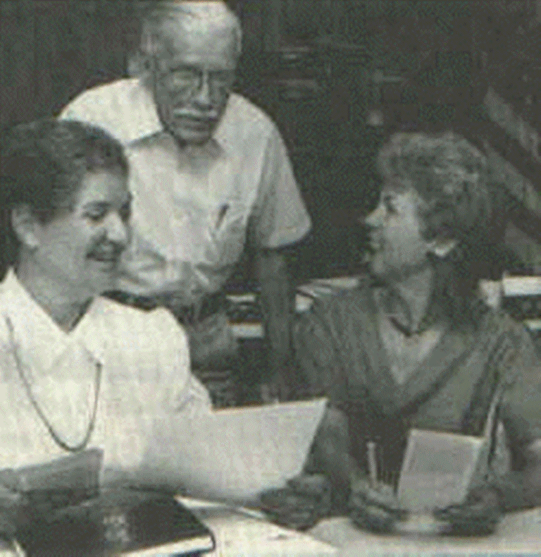 Checking Details for the History Book
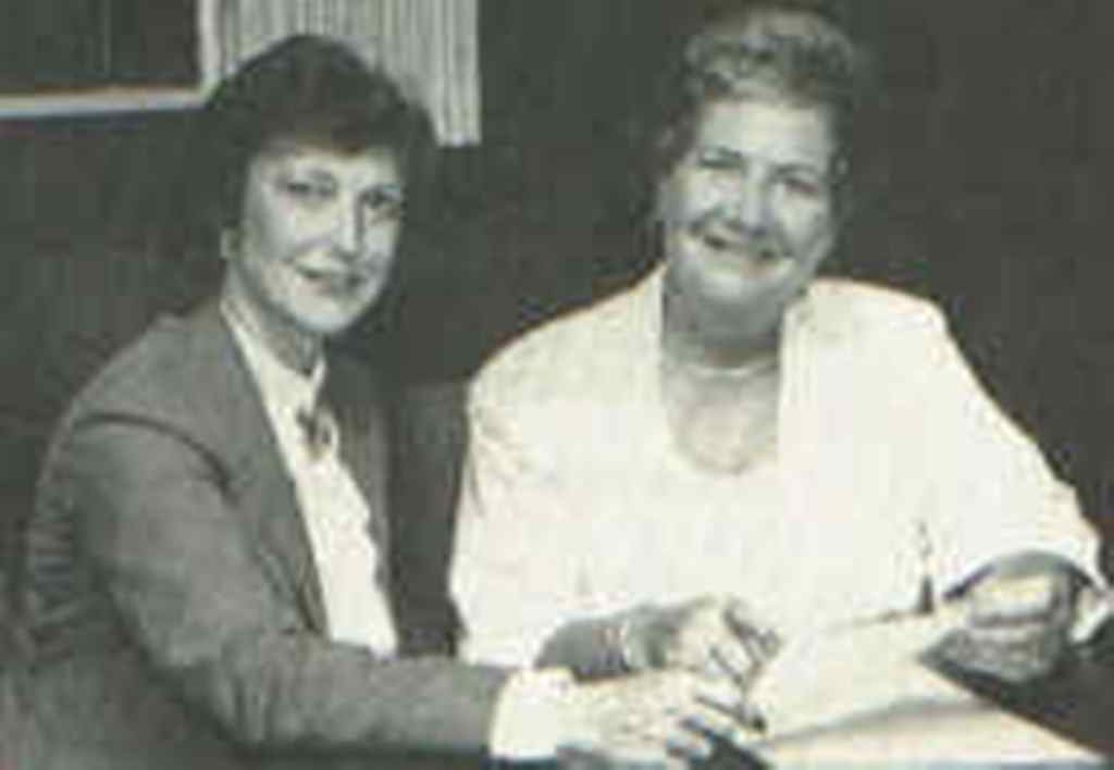 Overseeing the Publicity
 Purpose, Planning & Hours of Hard Work
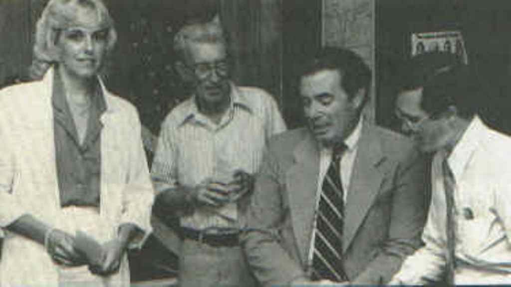 Planning the Parade and Harvest Festival
 Commission Members
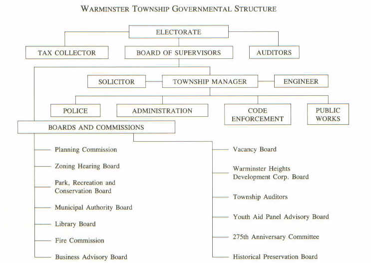
 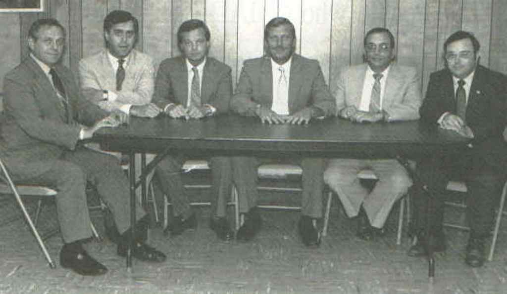 The Warminster Township Administration and Board of Supervisors
 The Warminster Township 275th Anniversary Commission
 WARMINSTER, England, 1879
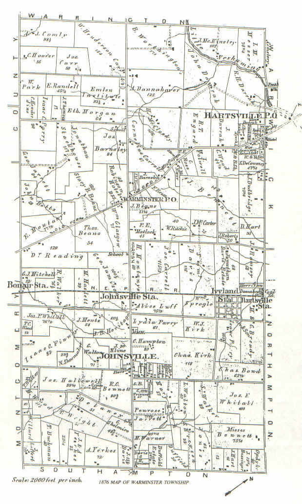 1876 Map of Warminster Township
Warminster was one of the earliest townships settled and most of the land was taken up by 1684, according to Holmes map of that date, although much of it was the property of absentee owners.
A few families began to emerge above the indistinguishable mass of early settlers. In the Warminster boro area they were the Nobles, and later the Yerkes and Beans. In Johnsville, they were the Longstreths and the Harts, later the Cravens. Hartsville's early families were the Tennents, the Beatty's, the Darrah's, and later, another branch of the Hart family. There were so many and it is with a great deal of regret that it is not possible, in this little volume, to dwell at any length upon more than a few. John Hart, the first of that name in Warminster, came to Pennsylvania from Whitney in Oxfordshire, England in the fall of 1682, preceding Penn by a few months. On Oct. 11, 1681, he had purchased one thousand acres of the Proprietary for 20 pounds and, on his arrival, located 500 in Byberry and 500 in Warminster. In 1683, he married Susannab, daughter of his friend John Rush. Mr. Hart was at first a minister among Friends but later became a Baptist and, in this capacity, preached to a small congregation at John Swifts in Southampton, thus laying the foundation of the Southampton Baptist church. About 1695, Hart moved his family to his Warminster tract between Bristol and Street Rds., adjoining Johnsville where he died in 1714. The Harts were a prolific clan; John 2nd married Eleanor Grispin of Byberry in 1708 and had a family of ten children whose descendants Gen. Davis states, "-now (1876) number thousands and are found in all states south and west of Pennsylvania." Two of this ten reached positions of some distinction; Oliver, who studied theology under Wm. Tennent (2nd) at Freehold, N.J., and later became a famous Baptist minister in South Carolina; Joseph Hart became an officer in the Revolutionary army and was very active afterward in civil life. The family home of the Harts remained in the family for 170 years.
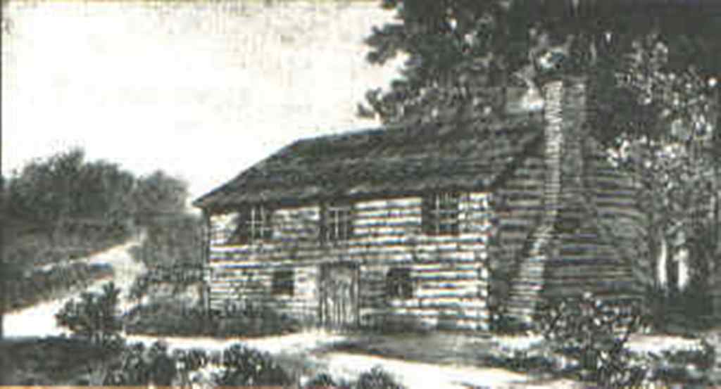
Bartholomew Longstreth was born in Longstrothdale, England, in 1679 and immigrated to Pennsylvania in 1698. In 1710, he bought 500 acres from Thomas Fairman in Warminster partially in what is now Johnsville, and built a log cabin for quarters. He married Ann Dawson, daughter of Hatboro's John Dawson, in 1727. Dawson was probably the first settler in Hatboro and it is said that Longstreth fell in love with Ann when he saw her carrying mortar and stone in her apron while helping her father build the Crooked Billet Inn. If this is correct, we don't wonder that Bartholomew was smitten on the spot; in those early days it took strong men to survive and prosper, and an equally strong partner in marriage for help and encouragement. Ann rode to the wedding at Horsham Meeting on a pillion behind her father and, after the wedding, climbed up behind her husband for the ride to her new home. No Niagara Falls or Bermuda at that day and age; honeymoons were for the very wealthy and there was immediate work that had to be done daily on a farm. This was not an era or place for "pantywaists" of either sex. In spite of his being 48 when he married, he managed to father eleven children during his remaining years. He was a township supervisor, and was responsible for opening the York Road from Hatboro to the Neshaminy in 1716. 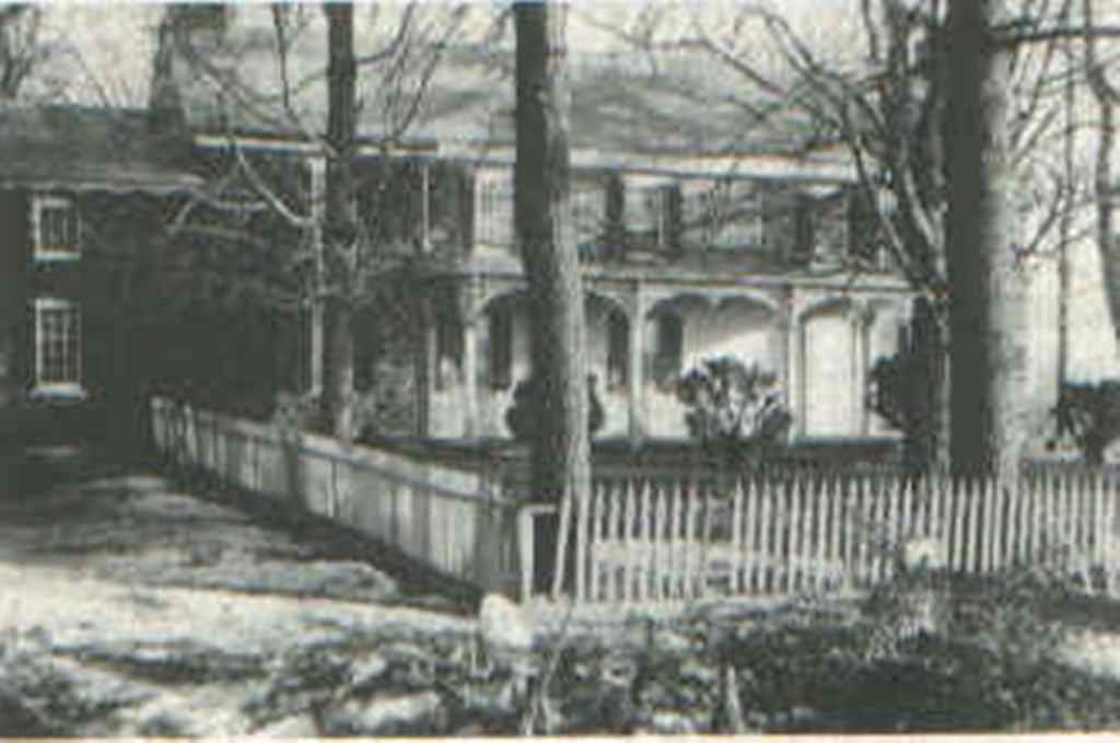 (JOHN LONGSTRETH HOUSE now on Navy property)
Longstreth was also instrumental in the building of Newtown Road, from County Line to Bristol Road. At the time of his death in 1749, he owned 1000 acres which was divided among his children.
The old Longstreth home was owned by five generations of the family and, since it was first built, has undergone extensive alteration.
In connection with Mr. Longstreth's opening of the York Road, it is interesting to note that, according to information received from Mr. Wm. Pennebaker of Hartsville, most of the lands on and adjoining the present York Road were not taken up until after the road was opened in 1716. If this is correct, it could lead to an interesting puzzle; was there an open strip of land from Hatboro to the Neshaminy purposely set aside in the anticipation of the road to come, or did York Road simply follow a line of unclaimed ground which determined its eventual course? Mr. Pennebaker states that he can produce references to support his statement, even though some of the early maps are in contradiction.
Another anomaly in the course of history has been called to my attention, again by Mr. Pennebaker, who has done extensive research among the old records at both Philadelphia and Harrisburg. This one is in reference to the Noble tract. The histories seem to agree that Abel Noble was among the earliest of settlers in the township, being an original purchaser of land in Warminster. Davis History of Bucks County states that "-he owned 695 acres at the resurvey in 1702," and then goes on to say that the original Noble tract "lay on both sides of York Road." According to Mr. Pennebaker's information, this is incorrect, the original tract did not extend as far west as York Road and Able Noble increased his boundaries only after York Road was built. This is important to the historian in that it effects the probable date of several of the properties of uncertain vintage now facing York Road not to mention other phases of county history in which the Nobles were involved. 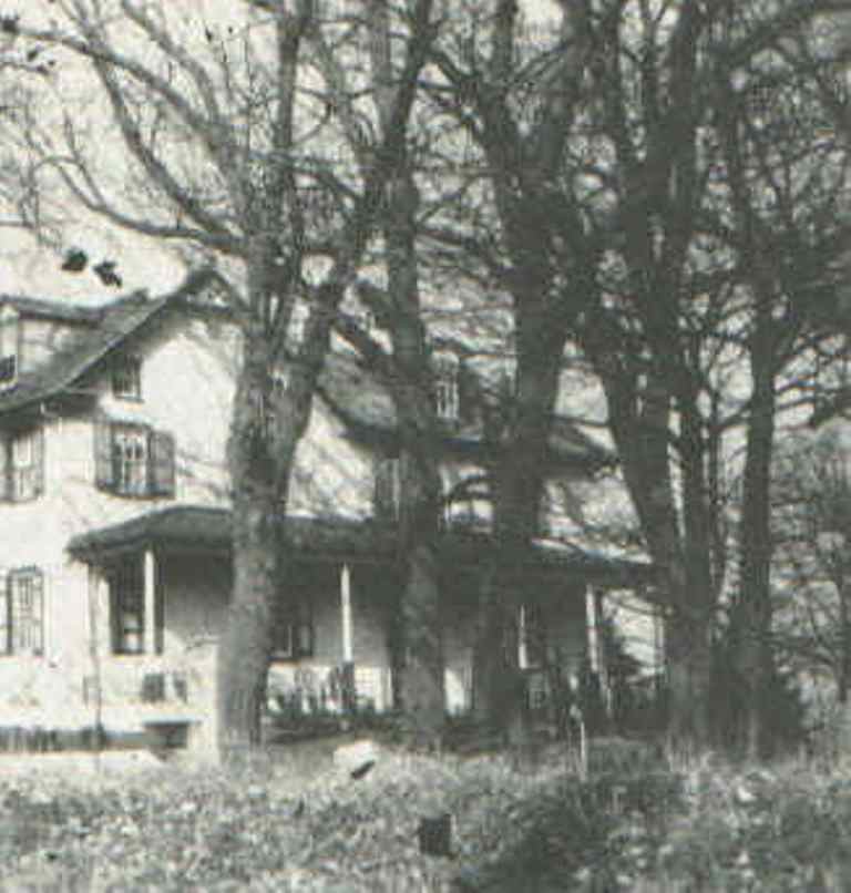 (NOBLE HOMESTEAD in the 1940's. Later Fireside Inn. Northeast corner, York Road and Beech Street)
The Nobles are considered to be among the very earliest settlers in Bucks County. Richard Noble held a local office under the Duke of York in 1675. He was a surveyor and settled on a tract of land in Bristol Township above the mouth of the Neshaminy. Available sources do not state at what date his son Abel first came to Warminster though one informant claims it was 1684. This has yet to be authenticated. The boundaries of the original Noble purchase are left in doubt in the light of the aforementioned information, but we do know that Noble eventually owned 695 acres which extended on both sides of York Road, of which he conveyed 165 acres in 1743 to his son Joseph, who, in 1762, sold it, and a few more, to Harman Yerkes, the first of his family in Warminster. Abel, 2nd and Job Noble were sons of the first Abel and, between them, still owned most of the original tract at this time.
 (NOBLE HOMESTEAD as the Fireside Inn, 1957)
Job's home was much later to become the Fireside Inn at the northeast corner of York Rd. and Beech St. The building burned down some years ago and is now the siteof a small shopping center. In 1734, Abel the first conveyed to Job Noble a house and 40 acres. He, in turn, transferred it to his daughter, whose married name was Gilbert. This house, located at the northwest corner of York Road and 5th Avenue, recently owned by Mr. Philip Reeves, is now an office building.
The Noble family burial ground is located high in the field back of, and slightly westward, of the Calvary Community Church on County Line between Madison Avenue and the Reading Railroad. (Site of the NOBLE FAMILY CEMETERY On Hill back of Wolverton's Welding, County Line Road)
The Yerkes family has been one of the most constant in the history of the township, having been large landholders and farmers here for almost 190 years. It is interesting to note here just why it is that a prominent name dies out in a community. In the early times, sons were more or less expected to follow in the paths of their fathers and estates were divided among the sons. As an area grows, however, so does opportunity grow in surrounding areas and the sons of the family are lured to the greener grass, or to trades and professions more to their liking. In any one generation, if there is a predominance of daughters and the few sons decide to stretch their wings, the family name in that area must become extinct. The last of the Yerkes family in Warminster were Elizabeth and Louise Yerkes who owned the family homestead at Jacksonville and Street Roads. The two maiden ladies died in 1951 thus bringing to an end the name of Yerkes as large landholders in Warminster.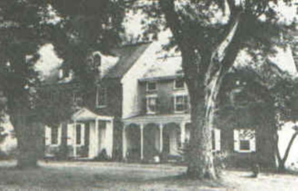 (YERKES HOME Street Road. Demolished by Hurst Corporation)
The story of these two ladies starts back in 1762 when Harman Yerkes bought 181 acres of the Noble tract on Street Road. He was the grandson of Herman - or Harman, as it was pronounced - who was the brother of Anthony Yerkes. The two brothers immigrated from Germany about 1700 and Anthony became burgess of Germantown in 1703. Our Warminster Harman (3rd) gradually increased his property until it included a large part of the Noble tract. It was later divided among his sons, Andrew and Harman, 4th.
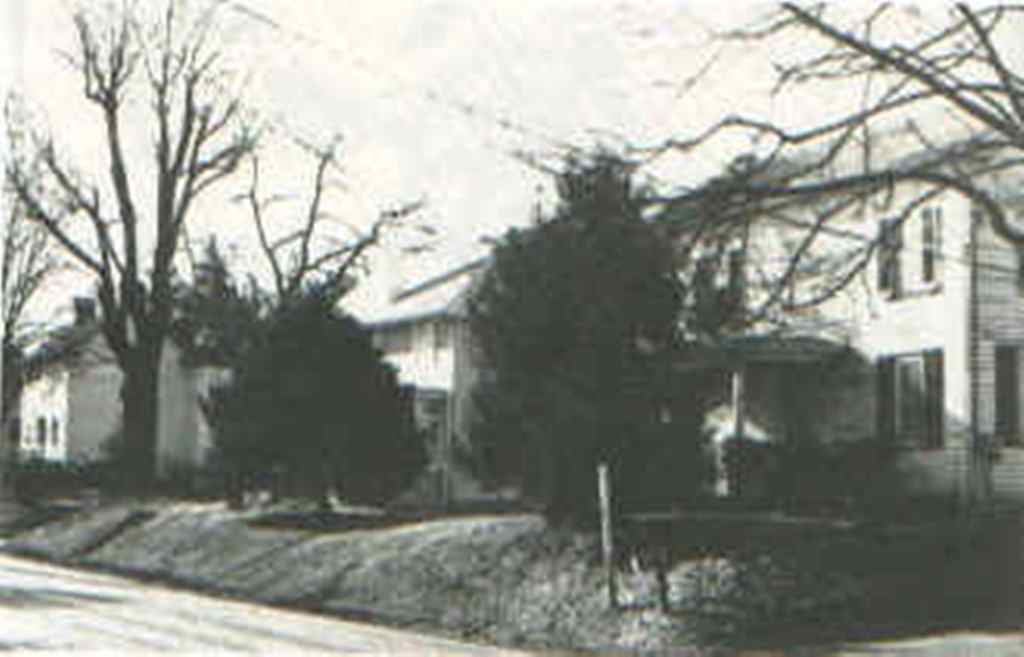
The family spread across Warminster during the last century to become one of its "first families." In 1826, Elizabeth Yerkes married John Craven Beans. Mr. Beans was a member of another prominent family of the times. 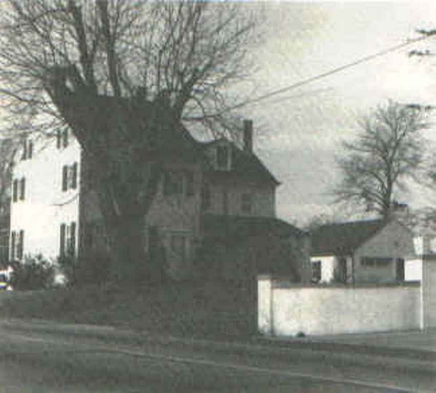 (MONTANYE HOME North side of Street Road, west of Louis Drive. Demolished in widening of Street Road)
Judge Harman Yerkes was admitted to the Bucks County bar in 1865 and was an eminent and highly respected president judge for many years. Clarissa Yerkes married Samuel Montanye, son of Thomas B., who was pastor of the Southampton Baptist Church. Most of the sons and daughters married locally in that day and we find certain local families of many different names having a common ancestor. Many of the middle names were the maternal family names, such as John Craven Beans, son of Thomas Beans and Christiana Craven. Many of the descendants of these families still live in and around Warminster although the day of the large land-owner is drawing to a close in a fast growing township.
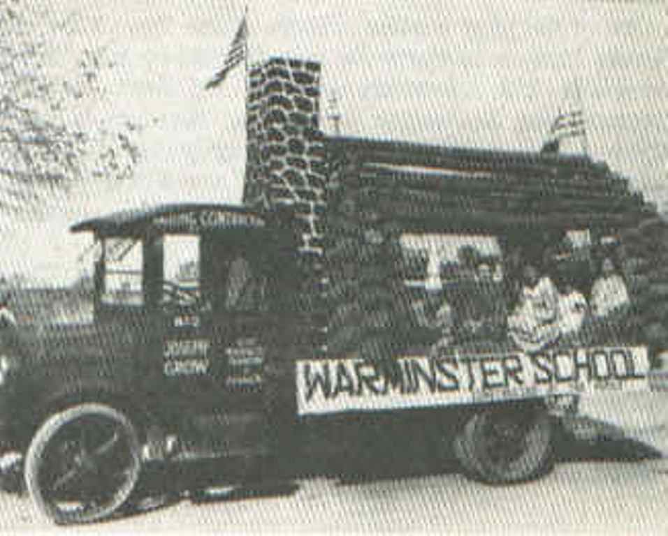 (Warminster Celebrates the opening of the new school in 1928)
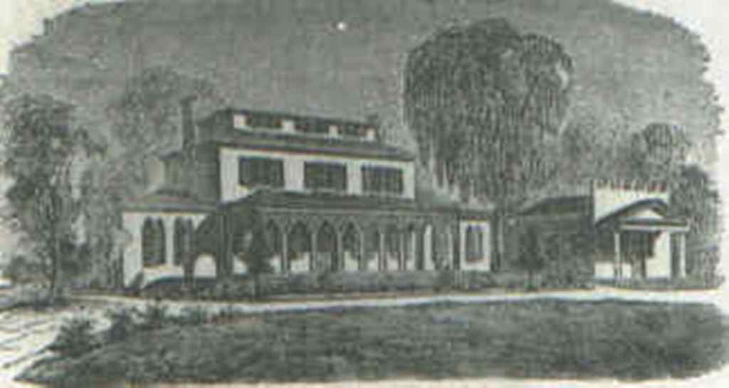 (ROSELAND FEMALE INSTITUTE; now Hartsville Inn at intersection of Old and new York Road)
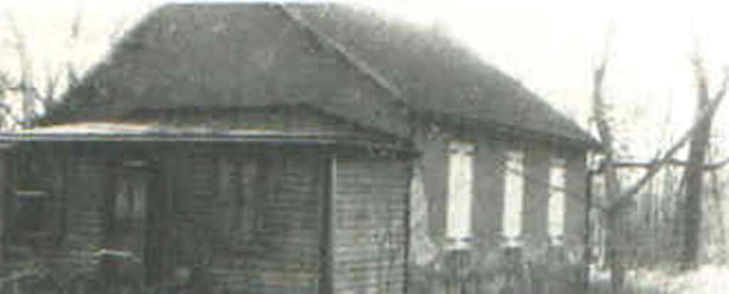 (OAK GROVE SCHOOLHOUSE; Street Road across from Catherine Street - Demolished)
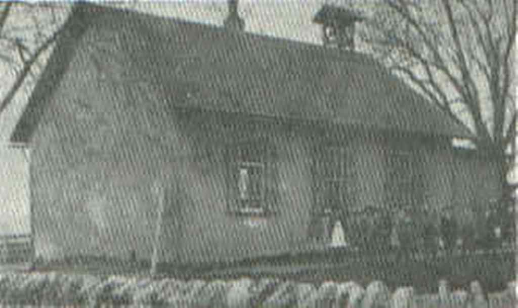 (JOHNS VILLE SCHOOL also known as Prospect Hill School Street Road, east of Centennial Road- Demolished)
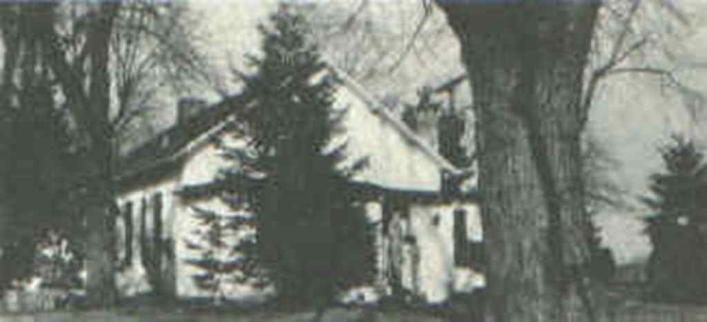 (Left - WILLOW DALE SCHOOL; Southeast corner of Street Road and Norristown Road - Demolished)
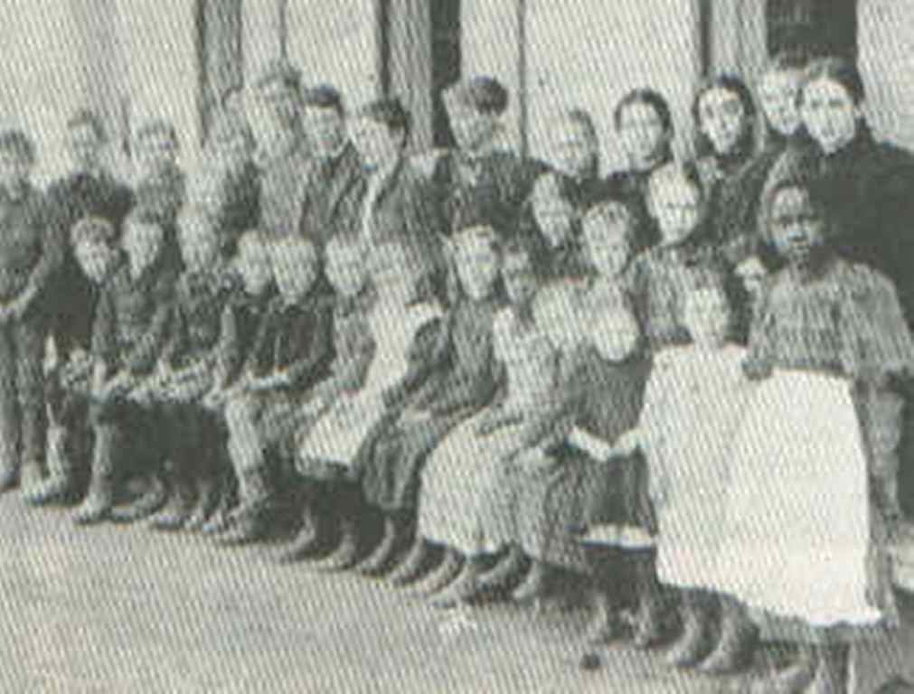
 (CLASS OF 1908 at the Johnsville School)
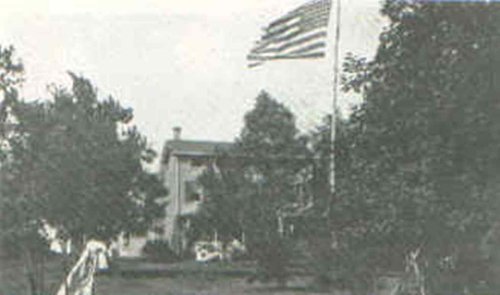 (ST STEPHEN'S ORPHANAGE; Located on the site of Christ's Home Retirement Community - Demolished)
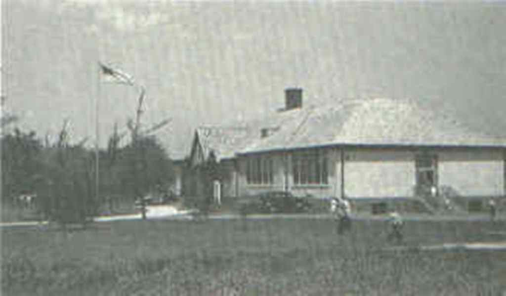 (WARMINSTER ELEMENTARY SCHOOL; Built 1928. On Street Road at Madison Avenue, Now an office building)
"We had for our Chaplain a Zealous Presbyterian minister, Mr. Beatty, who complained to me that the men did not generally attend his prayers and exhortations. When they enlisted, they were promised, besides pay and provisions, a gill of rum a day, which was punctually served out to them, half in the morning and half in the evening, and I observed they were punctual in attending to receive it; upon which I said to Mr. Beatty, 'It is perhaps below the dignity of your profession to act as the steward of the rum; but if you were to distribute it out, only just after prayers, you would have them all about you.' He liked the thought, undertook the task, and with the help of a few hands to measure out the liquor, executed it to satisfaction; and never were prayers more generally and more punctually attended..."After returning to Warminster from this expedition, Mr. Beatty further showed his patriotism and knowledge of human nature. During the French and Indian War, after being appraised by an enlistment officer that the people of the neighborhood were reluctant to be recruited in defense of the Pennsylvania Province, he told the recruiting officer to be at service the following day, which was Sunday. At the close of the service, he addressed his people in words to this effect:
"The savages have attacked the frontier settlements and are murdering our fellow citizens. The Governor has made a call for volunteers to march with a view to attack and drive them back, but I regret to learn that it is not very promptly met. It is certainly somebody's duty to go, and I have determined, if the Synod allows me, to offer my services as Chaplain, and thus do my part. Of course it would be very pleasant for me to have the company of any of the congregation, or my neighbors, who may feel it their duty to go."During the following week, about a hundred men joined the company. Here, indeed, was a salesman! Who sold duty to mankind as well as duty to God. It was during this campaign that he wrote in his journal:
"Thursday, May 20th. Preached at Yellow Breeches, over Susquehanna, in a meeting house belonging to Presbytery of Donagal, at the people's invitation. Returned in the evening to camp; one of my pistols went off as I was laying it down, but, God be praised, did no hurt."This was a man's man. Although a man of God, he carried not one, but two pistols, probably reasoning that with all the good Lord's troubles, why bother Him if, in time of need, he could take care of himself. In 1758 he served again under General Forbes in the march against Fort Duquesne, now Pittsburgh. One of the men who accompanied him in this campaign was Ensign James Darrah, an ancestor of the present Darrah family of Hartsville.
 ketch of Log College has an interesting story. It is presented here as told by Mr. Murphy in his book "Cradle of the American Presbytery":
 "Beyond the brief description in the Journal of Rev. George Whitefield, the appearance of the building has been a mystery. No picture, or description, has been supposed to be in existence. The author is indebted to Dr. W. S. Steen [for a description considered, under the circumstances, as reliably authentic]." "While engaged in geological and kindred pursuits at the Yuba mines, in California, he made the acquaintance of a man named Wilson, a pious and intelligent miner, in whom he became greatly interested. Both being natives of Pennsylvania and members of the Presbyterian Church, they would seek refuge in the forest on the Sabbath from the noise and profanity of the mine, and there study the Bible. On these days Wilson related his previous History. He was of pious ancestry in eastern Pennsylvania. A grandfather had importuned him to study for the ministry of the church of his forefathers and among other inducements, had presented him with a Bible in which there was a picture of "the first col lege established in this country for the training of young men for the ministry." It looked as if it had been an illustration from an old pamphlet or had been sketched by some bright youth of the institution. The building was small and rude, of logs, and located in eastern Pennsylvania, among the Presbyterians. On this picture, as a reminder of their far off home, the two had gazed times without number. Dr. Steen came to have it so fixed in his imagination and memory that he could recall it with the utmost vividness. Failing by correspondence to find either Wilson or the Bible, at the author's solicitation he described the picture so exactly that the designer had no difficulty in reproducing it with the utmost accuracy. Of this, the Doctor has given the accompanying certificate with the liberty of making it public: "I do hereby certify that the accompanying engraving is an exact reproduction of a picture of the first college building for the ministry of the Presbyterian Church in eastern Pennsylvania, and which was constructed of logs, which I frequently saw in a Bible of a pious miner of the Yuba mines of California and which he received as an heirloom from a grandfather whose ancestral home was in that region of the State."
W. S. Steen
San Francisco, California
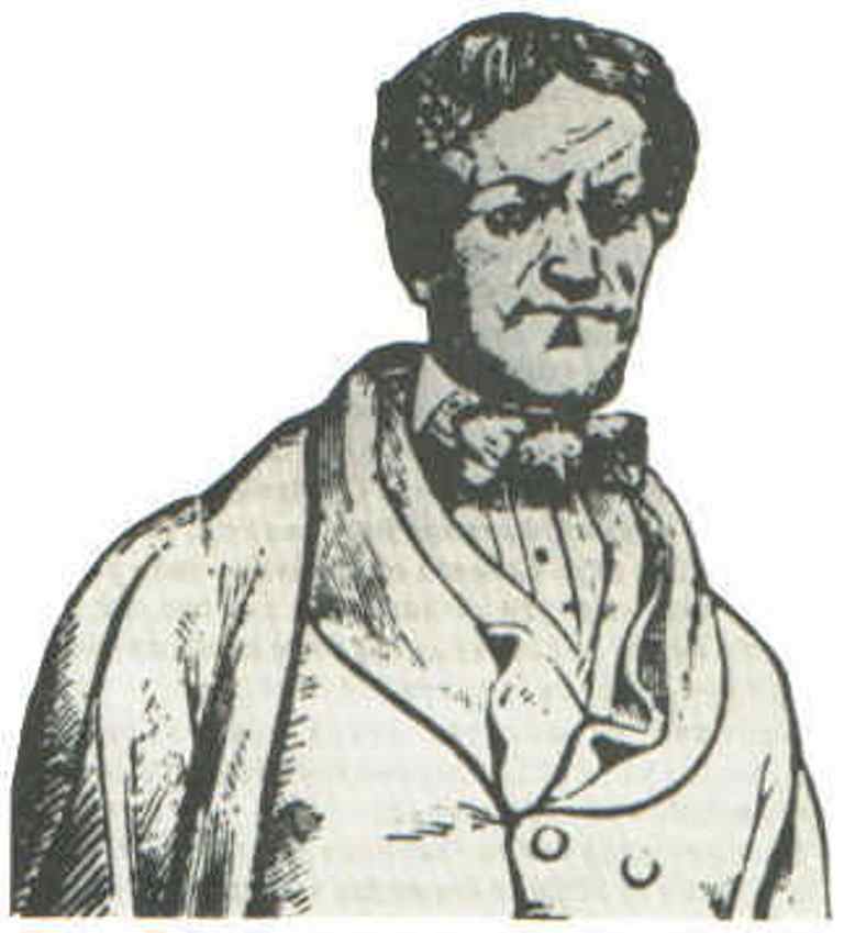 (Sketch of John Fitch)
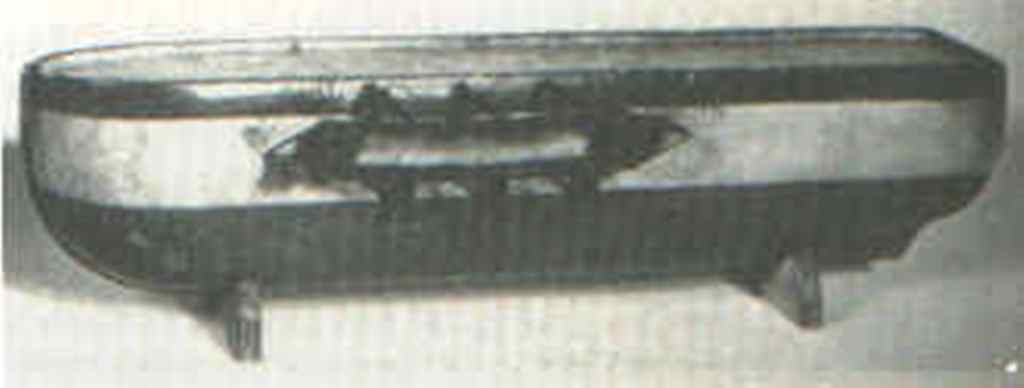 (Fitch 's First Conception of a Steamboat. His model of 1782 [Courtesy. American Philosophical Society])
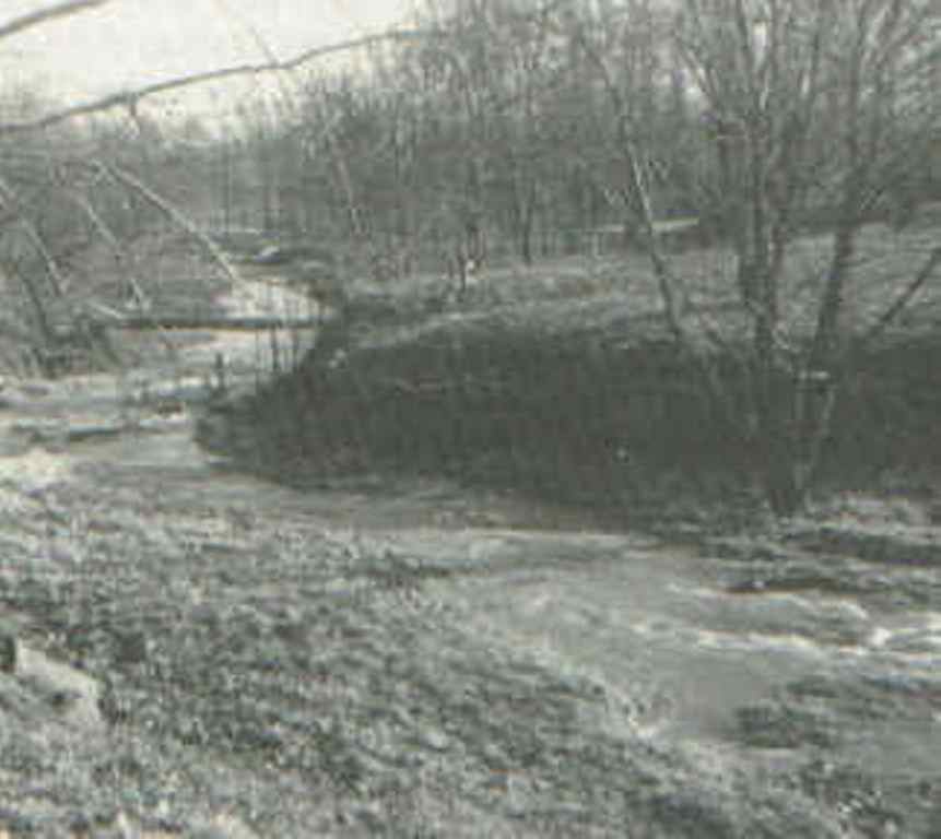 (Site of Fitch 's first tests in Davisville)
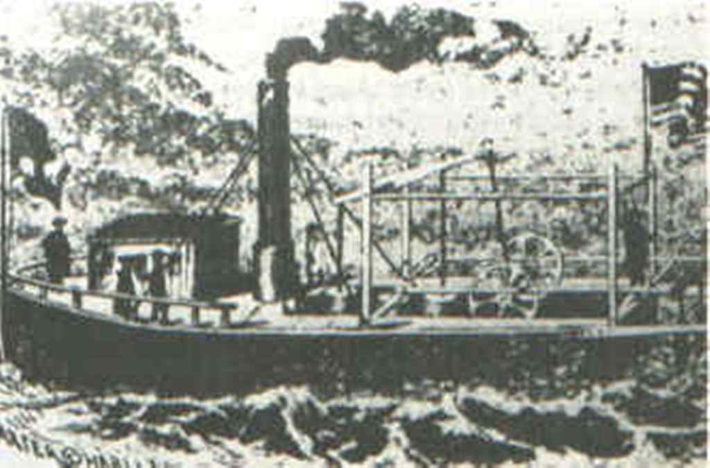 (The 1790 model had paddles at the stern)
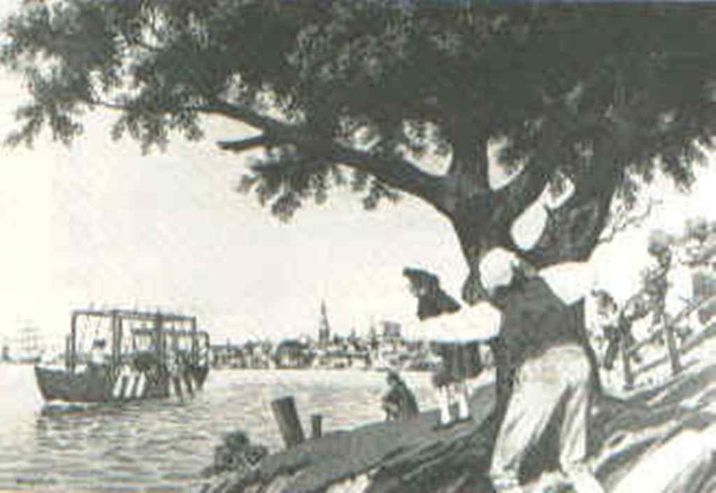 (Fitch 's model of 1786 carried passengers on the Delaware River)
The Township contributed many names to the roster of those who served in the War of Independence - Darrah, Longstreth, Yerkes, Hart, Beatty and many more - all familiar in Warminster history.
During that war, the township saw Washington's army pass through on York Road several times in its travels between Philadelphia and Coryell's Ferry, now New Hope. The new flag of the Republic was first flown in the encampment a half mile above Hartsville along the Neshaminy Creek. The Battle of the Crooked Billet started in Hatboro and ended in the woods of Warminster. During that engagement, blood was spilled upon Warminster soil over the whole southeastern part of the township.
The details of this battle - if it can be termed thusly - are given in a paper presented by Mr. Charles Harper Smith before the Old York Road Historical Society on February 20, 1945. Mrs. Smith has kindly permitted the use of the paper in this township history. A condensed version is presented herewith depicting "-a skirmish which took place 166 years ago [in 1945], involved fewer than 1200 men, failed of its purpose, and reflected little glory on either the staff work or the valor of the contestants." While these words of Mr. Smith may be a blow to local pride, history has a way of being, above all, necessarily practical and objective. Mr. Smith's review is one of the most authoritative that I have come upon and I prefer to put it in his own words. Its compact form has left out none of the details so interesting to the casual reader and I regret having to condense it further hoping that, in so doing, I have not destroyed the continuity and flavor of authority which pervades the original text. The brackets are my own and are used for my own comments and to provide continuity;
The Battle of the Billet was fought on the morning of May 1, 1778, near the town of Hatboro, then commonly known as "the Billet," a short form of the name of its widely known Crooked Billet Tavern.
It was one of several minor engagements between American and British soldiers fought within the present borders of Montgomery County during General Howe's occupation of the City of Philadelphia. It is undoubtedly the best known of these minor actions, although it cannot be said to have been the most important. On the contrary, it had a purely local and temporary objective. The greater publicity given to the Battle of the Billet is due largely to the fact that it ended in Bucks County and became a favorite theme of that county's historians [of which there were many]. General Davis' interest was carried forward to recent years by the late Warren S. Ely of Doylestown. In 1928, he joined with Dr. John B. Carrell of Hatboro and Howard T. Hallowell of Jenkintown in placing a second monument [the first being on Monument Avenue in Hatboroj beside the Jacksonville Road, in Warminster Township, near the scene of an atrocity perpetrated by the British during the battle.
The battle was the culminating event in a six months campaign to prevent the British from receiving food and other supplies from the rich farming district north and northwest of the city. The campaign had been entrusted to the Pennsylvania Militia and its [23 year old] commander, Brigadier General John Lacey, Jr., of Bucks County. It was the only independent campaign assigned to the State Militia during the Revolution, and it demonstrated the futility of putting untrained civilian conscripts against seasoned veterans. But while the British were able to raid Lacey's territory with impunity whenever they chose to come out in force, he succeeded in cutting off a large proportion of their potential supplies by intimidating those farmers who preferred to exchange their produce for British gold instead of depreciated Continental currency. The British were willing to pay enormous prices for supplies. One blockade runner testified at his court martial that he had sold a pair of turkeys for 18 pounds, nearly $75.00 at the present rate of exchange.
The British finally decided to put an end to this nuisance by sending out a force large enough to kill or capture Lacey's entire brigade, and to do so at a time when his men would be unarmed and practically defenseless.
Lacey had been promised a constant minimum of 1,000 men but the Supreme Executive Council was handicapped by the Militia Law of 1777, which limited each man's tour of duty to six week's active service. The result was that Lacey at times had only several hundred men in his command, and at others was reduced to a mere handful, incapable of defending even his headquarters post. The second half of April was one of the latter occasions. Lacey was compelled to abandon his forward outposts and withdraw with his few remaining men to his Billet camp, there to await reinforcements. The camp lay immediately north of the village in a wooded tract of some 20 acres. Its west end flanked the York Road, and its south side paralleled the present East Monument Avenue.
By April 27th the long awaited reinforcements had begun to arrive. Detachments of two battalions straggled into camp from day to day. General Davis records that "a body of militia" arrived on the evening of April 30th. Davis makes the further statement that the new soldiers were "without arms" and in this he is undoubtedly correct for the shortage of muskets and ammunition was so great that no supplies were available for county commands and were issued only when the men reported for duty in the combat zone.
By taking Lacey's official return of May 14th and adjusting it for battle losses, it is possible to make an accurate estimate of his strength on the evening of April 30th. The tally is as follows:
Captain Pugh's Company . . . . 21
Colonel Smith's Battalion . . . . 165
Colonel Watt's Battalion . . . . 147
Total . . . . 333
Of this total, 33 were either sick, on furlough, or had already been discharged, leaving an even 300 present and fit for duty.
Lacey took the usual precautions for the protection of his camp overnight. He appointed Colonel Watts officer of the following day, posted sentries about the camp, and detailed scouting parties to patrol the roads in the direction of the city. [In the meantime] the British had been kept informed of the American troop concentration through their network of Tory spies in the neighborhood and were convinced that this was the opportunity for which they had been waiting. Accordingly, they sent out two columns from the city at about 11 o'clock on the night of April 30th, intending to attack Lacey at daybreak from two sides in the classic pincers movement.
One column was made up of 10 companies of the notorious Queen's Rangers, recruited largely among American born Tories in Philadelphia and commanded by Major John Graves Simcoe of the British Army. The other column consisted of 14 companies of Lieutenant Colonel Robert Abercromby's regiment of light and heavy infantry. Simcoe's force numbered about 325, and Abercromby's 525, a total of 850 officers and men.
The strategy decided upon called for Simcoe to make a surprise attack on Lacey's camp just as dawn was breaking, having circled it from the east and northeast to cut off his line of retreat into Bucks County. Abercromby was to approach from the west and lie in ambush along the probable line of American retreat, thus trapping the rebels between two fires.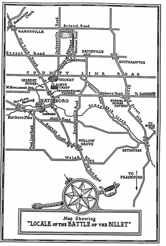
[Simcoe approached Hatboro from Bethayres along Pioneer Road so that he could approach the camp from the northeast and cut off escape toward the Neshaminy. Abercromby approached by way of the Easton Road, turning right into Horsham Road.] This was then a densely wooded section, where the road ran for some distance through a narrow defile between an embankment and mill pond of Daniel Thomas' Mill. This was the spot chosen for the ambuscade.
Both columns fell behind schedule but neither knew the other was late and day was now breaking and civilians were beginning to move about. Abercromby was sighted just above Willow Grove by young Joseph Hallowell.
Abercromby became afraid that Simcoe would drive the enemy past the point of ambush before his own slow moving troops could reach it so he sent Major Crewe and his dragoons ahead. Crewe found nobody at the ambuscade and patrolled down the road as far as the York Road intersection, where he was fired upon by Lacey's sentry, posted on the Pennypack bridge. According to tradition, the sentry was Abraham Sutphin of Warminster, brother-in-law of Cobe Scout. Realizing that the alarm had been given, Crewe galloped to the west end of the village where his men took their station at York Road and County Line. By this time, Simcoe was approaching the intersection of Davisville and Pioneer Roads. As soon as he heard the gunfire at the bridge, he sent Kerr and his light horse company directly across the fields to the American Camp.
The American scouting parties had not reported and the camp was not aroused until Crewe's men were almost upon it. Simcoe's men were still some distance away, however, and the road to Bucks County remained open. Without hesitation, Lacey decided to make a run for it. The County Line was about a half mile away, with a cultivated field nearest the camp. Beyond it to the right was open country to and across the County Line, but to the left was a dense thicket along Warminster Creek, on what was long known as the Goentner property.
Lacey had marched his column part way across the field when his baggage train and rear guard were set upon by Kerr's light horse from the right and Crewe's infantry from the left and rear. All the baggage wagons were cut off, and few of the guard escaped death or capture. The main column then veered to the left and as it reached shelter, Simcoe attempted a well known military ruse. Riding far ahead of his Rangers, he dashed to the edge of the thicket and in a loud voice called upon the Americans to surrender, at the same time ordering his own troops to charge. But Lacey was not deceived; instead he closed his ranks, broke through Crewe' s dragoons [who had dashed up from the York Road intersection], crossed County Line Road in close formation, and plodded doggedly ahead across fields and along by-roads for a distance of a mile and a half until they reached a woodland near the Bristol Road, where they dispersed and shook off their pursuers. Their line of retreat followed the valley of Warminster Creek, crossed the Jacksonville Road, then the Street Road near Johnsville, finally taking the Newtown Road until they turned left into the woods. [These woods are believed to have been on what is now Munro Park.]
[The British failure to capture Lacey was due to several reasons, Crewe's disastrous errors in judgment being one.] After destroying the entire British battle strategy by failing to halt at the ambuscade, thus causing Simcoe's plans to miscarry, Crewe had suddenly reverted to that strategy on his arrival, and by lying inactive instead of rushing the camp, and had given Lacey his chance to escape. [Lacey's youthful daring and his knowledge of the area were another large factor in his escape.]
Lacey's casualty list, as reported in his official return, totaled 92 men, almost one third of his command. Of this number, 26 were killed, 8 were wounded, and 58 were missing.
After the tide of battle had passed, Simcoe's Rangers swept across the field and mutilated many of the American wounded. Nine bodies, some of them said to have been alive, were burned on a straw pile which stood in a field near the present monument on Jacksonville Road. This atrocity was witnessed by neighbors who flocked to the scene as soon as the British withdrew, and was attested by several prominent citizens before Justice Andrew Lang of Warminster. It was also admitted by [a British commander] Baurmeister, who attributed it to Abercromby's dragoons. Eyewitnesses said, however, that the British regulars behaved correctly, while the renegade Tories acted like savages. Several of the American dead were buried in the Noble family graveyard, and others in unmarked graves where they fell along the line of retreat.
The British claimed that their losses were seven men wounded and a few horses killed. If these figures can be accepted as even approximately correct, it must be concluded that the Americans either had no weapons, or were too demoralized to use them at any time, in an action that lasted for two hours or more. But almost all of them were frontiersmen, accustomed to firearms and it is inconceivable that they would have failed to fire their muskets if they had had them. Any suspicion of cowardice is refuted by their conduct later in the day; they reformed their lines near Hartsville and marched down the York Road back to their camp. The only reasonable explanation of their failure to offer more effective resistance is that few of them had any weapons other than their fists to fight with.
They found the campsite deserted. The British had already rounded up their prisoners, set fire to the camp, gathered all the booty they could lay their hands on and started back to the city. Most of the robberies occurred at farmhouses along the line of retreat and several residents of Warminster later filed claims for horses or household goods taken. Some citizens were also maltreated, notably the aged Thomas Craven, on whose farm the burned straw pile had stood. As he hobbled on his cane outside his doorway, returning troopers rode up and demanded his silver shoe buckles and other valuables. When he demurred, he was called a "d-d old rebel rascal" and was struck several blows over the head with a sword.
Council's reaction to the battle was expressed by Secretary Matlack in the following eulogy: "Your conduct is highly approved and your men have justly acquired great reputation for their bravery." Washington, however, was more realistic, his comment being: "You may depend that this will ever be the consequence of permitting yourself to be surprised."
Although it served no military purpose, the battle deserves a place in our history as a noteworthy local event and as a reminder of the minute scale on which operations were conducted during the Revolution, and the deplorable lack of staff work and individual efficiency on both sides, when compared to modern military standards.
While Mr. Smith treats the Battle of the Billet from the standpoint of strict history and military strategy, the present author wishes to point out that it did accomplish a purpose. Our country is very young and, in the robustness of its youth, the spirit of tradition, which is such a strong motivating force in the face of adversity such as war and depression, has had little time in which to become ingrained into us. Tradition is made by men and events and in contributing to local tradition, this particular event and these few men who fought and died for an ideal have given their small quota toward the eventual sum total of national tradition. With all its faults, this is a great country, and the ideals which inspired it are bravely shown in the courage and resourcefulness of men like those American men of the Billet.
 (BABYTOWN, Southside of Bristol Road)
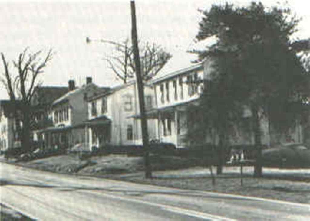 (BREADYVILLE, South side of Bristol Road)
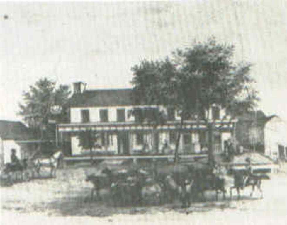 (WARMINSTER MANOR INN as it looked in the year 1859 )
 (HARTS VILLE HOTEL in the 1890's)
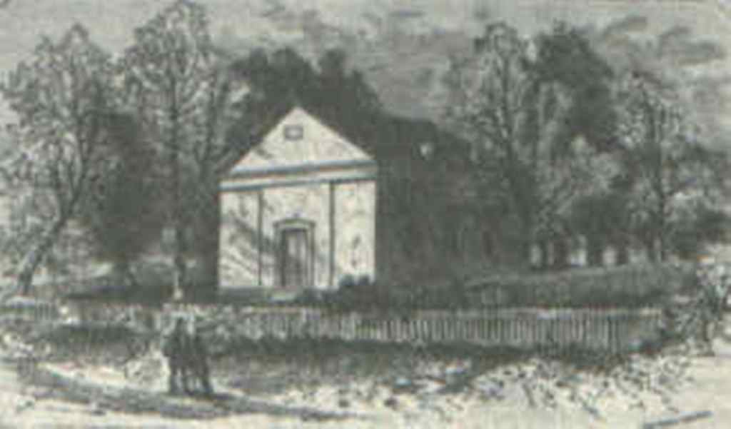 (Neshaminy Lecture Room, built in 1849, where the ladies of the church packed bundles for Civil War soldiers, it is now owned by the Hartsville Fire Company. Reproduced from Turner's History.)
 (Mid-l9th century engraving of Neshaminy-Warminster Church, with the Roseland Female Institute in the background, reproduced from a brochure advertising the school. The church was torn down in 1939 after the century-old ideological split was healed and the Warminster and Warwick congregations reunited. Collection of The Bucks County Historical Society.)
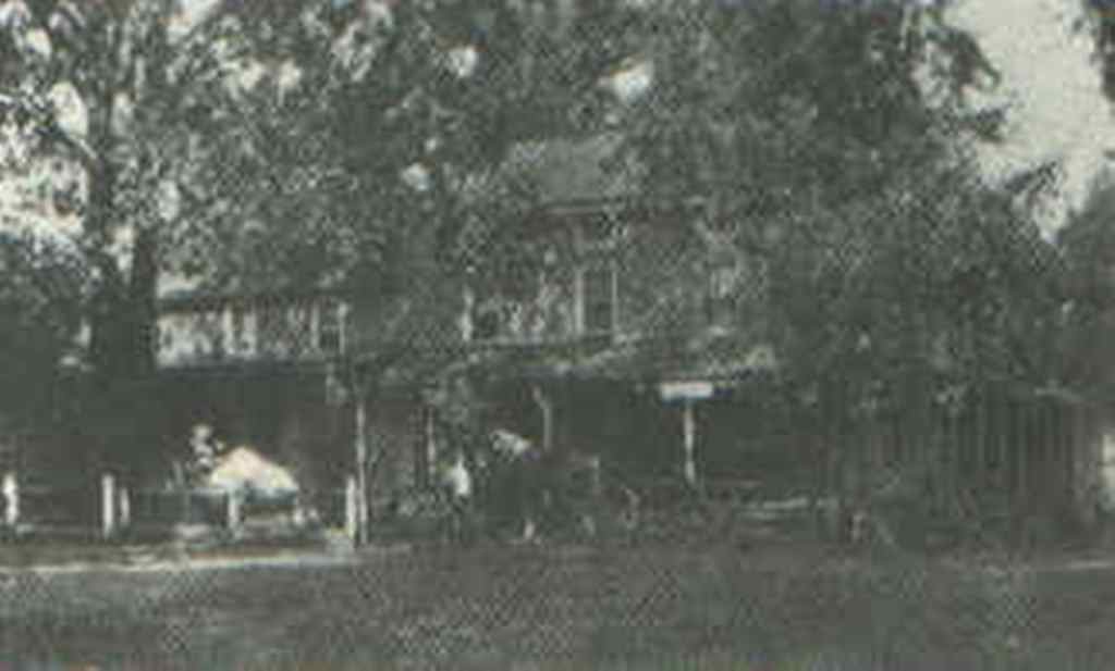 (JOHNSVILLE STORE & POST OFFICE 1905. Corner of Street and Newtown Roads.)
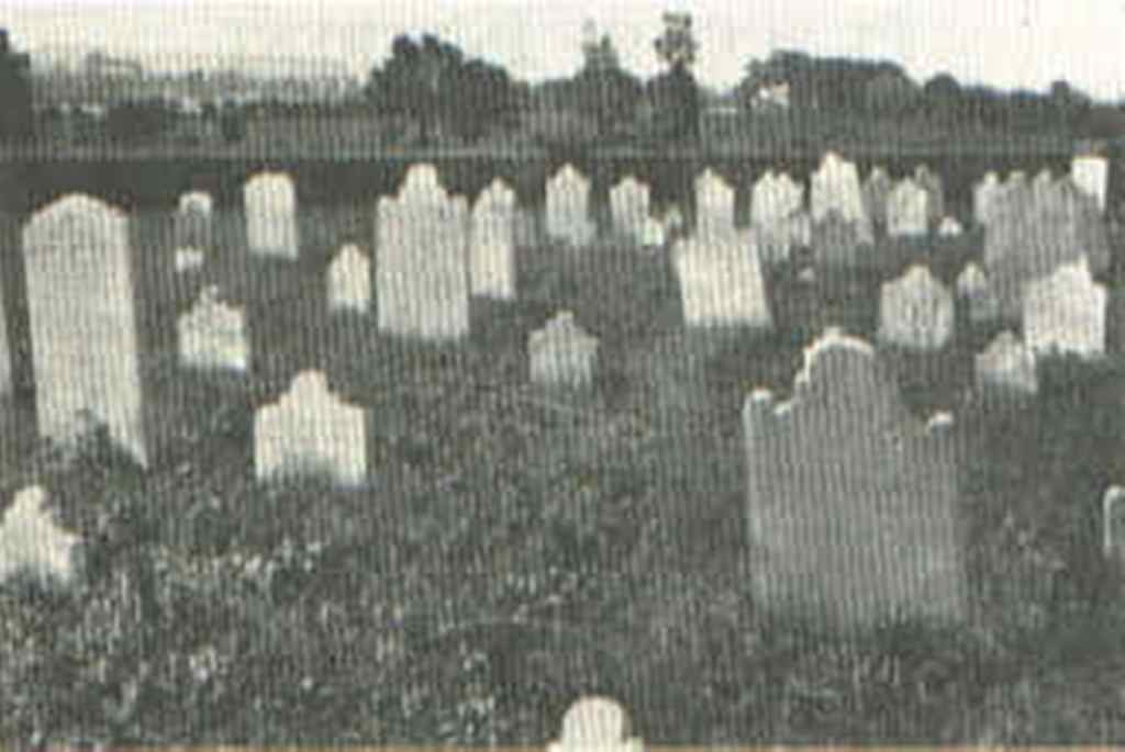 (OLD VANSANT GRAVEYARD, Johnsville; Here lie the remains of the early settlers - Cravens, McDowells, Garrisons, Sutphins, Vansants, Vandikes, and others -
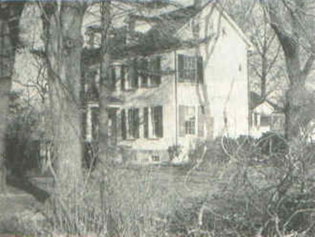 (CRAVEN HALL in the 1940's )
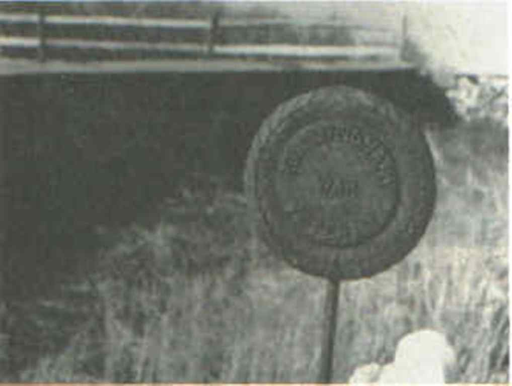 (BRONZE MARKER showing burial place of a Revolutionary War soldier in the Vansant cemetery)
 (BEANS AGRICULTURAL IMPLEMENT FACTORY; Was located diagonally across Street Road from Craven Hall. Burned down many years ago)
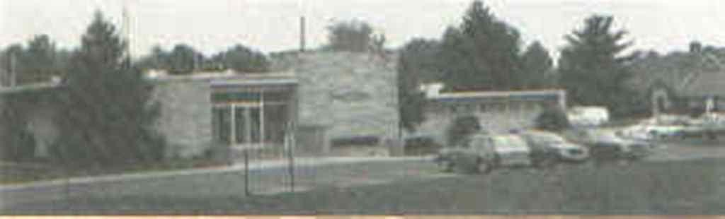 (WARMINSTER TOWNSHIP ADMINISTRATION BUILDING)
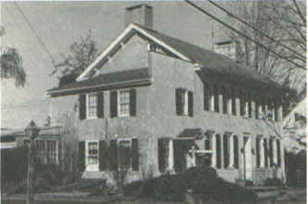 2) DARE HOME - On the southeast corner of Bristol Road and the Old York Road. Said to have been built by Rev. Charles Beatty. Now owned by the Dare family
 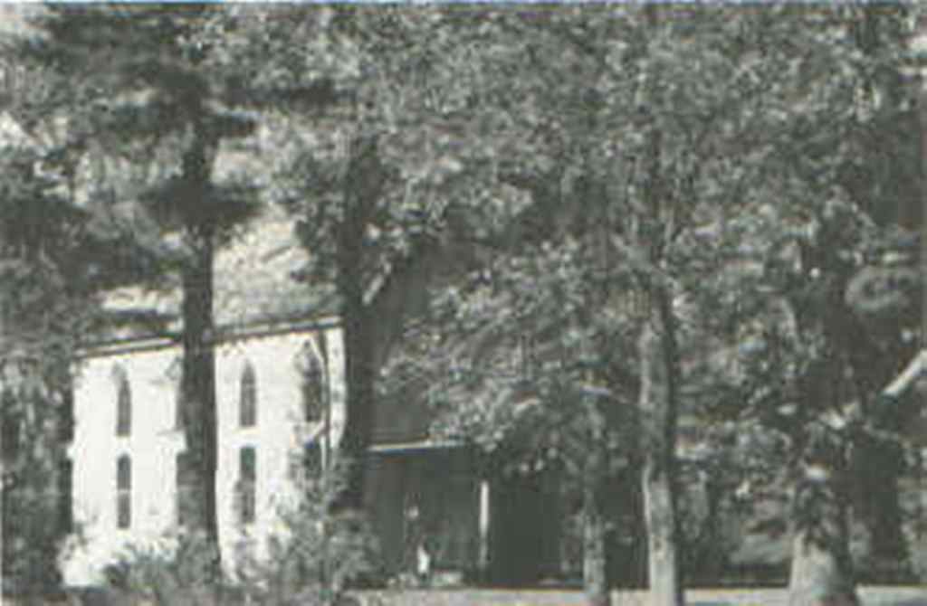 3) NESHAMINY WARWICK CHURCH - The first church in the Warminster area. The original building, where William
 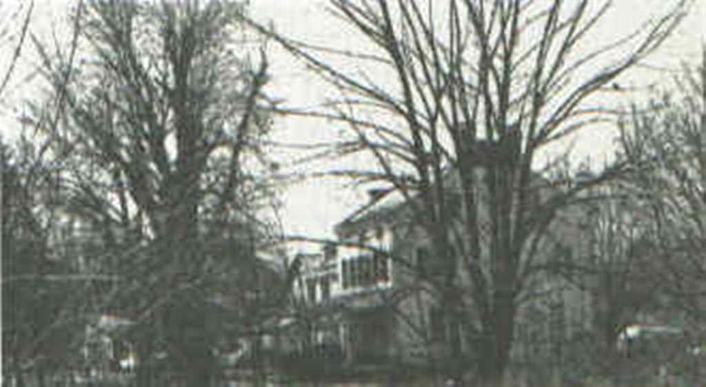 5) ROBERT DARRAH FARM - Situated at the south side of Bristol Road, not far from where the road makes an abrupt right turn across the old concrete bridge over the Little Neshaminy Creek. This was the home of one of Hartsville's oldest families.
 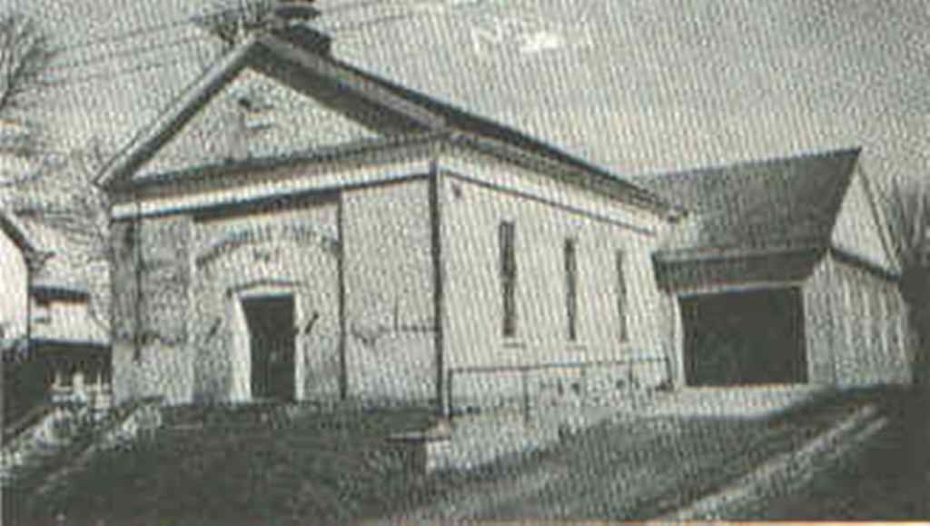 6) LECTURE HALL - On the east side of the Old York Road. Originally built in 1849 as a public building, by the Ladies Society of the Neshaminy Warwick Church, it was used until recently to house the Hartsville Fire Co. #1.
 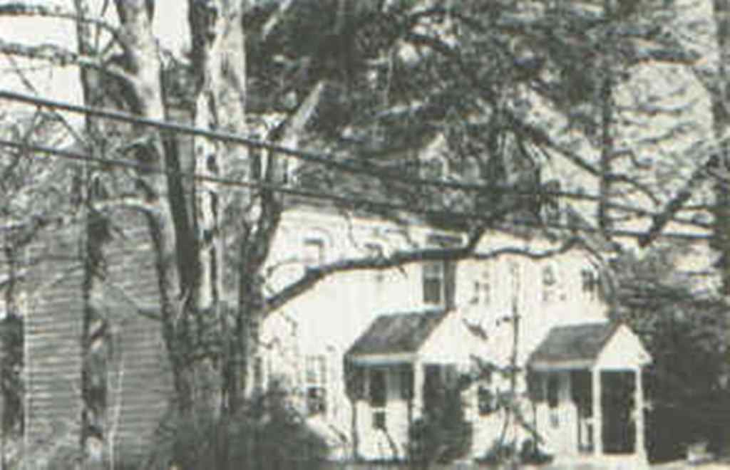 7) POLLYHART - On the west side of York Road, diagonally across from the Lecture Hall. Built sometime before 1835 by a carpenter named Benjamin Wright. Originally the home of Jane Craven, it later belonged to Rev. D. K. Turner, a pastor of the Nashaminy Warwick Church. Rev. Turner wrote several books on area history in this house. Presently the home of Pauline Bush.
 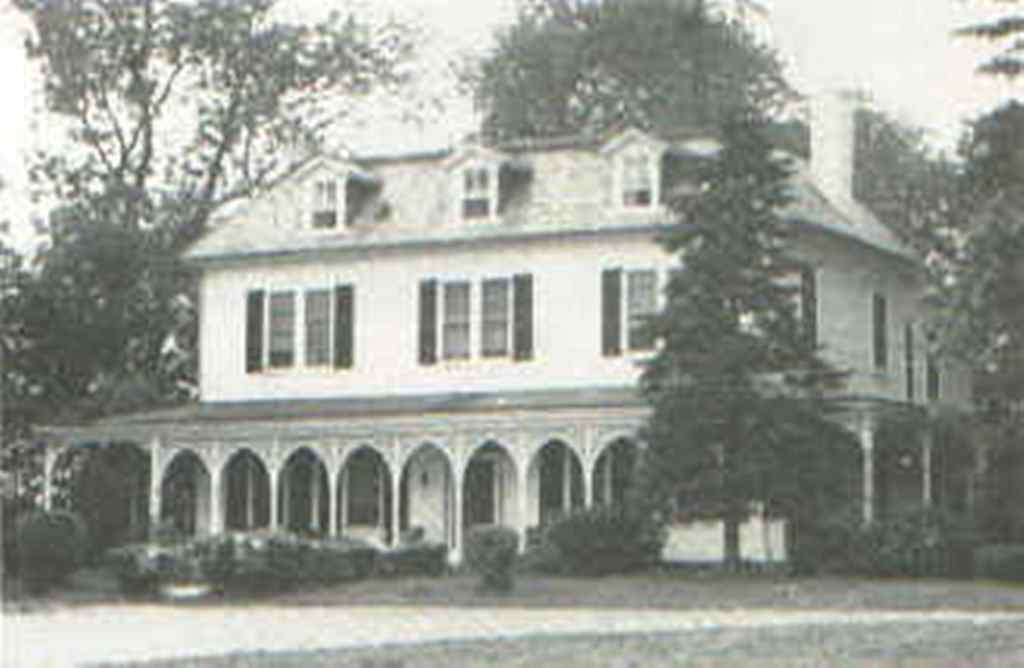 8) HARTSVILLE INN - Located on the west side of the intersection of the old and new York Roads. Built by Rev. James P. Wilson in 1832 as a classical school for boys. Later, in 1850, it became a school for girls under Rev. Jacob Belville.
 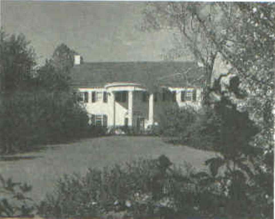 9) KLINE HOME - West side of the intersection of York Road and Norristown Road. Property once belonged to Rev. Matthew Wilson, who married a young lady from Georgia and, in deference to her southern tastes, erected the pillared facade on the front of the building. Was once the home of Dr. John Beans Carrell, a well known area historian. This beautiful showplace is now the property of Mr. and Mrs. Fred Kline.
 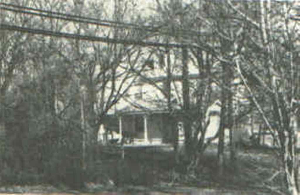 10) TENNENT HOUSE - Located on the west side of York Road just north of Christ's Home. Said to have been the residence of Rev. William Tennent while he was pastor of the Neshaminy Warwick Church and while he taught at Log College.
 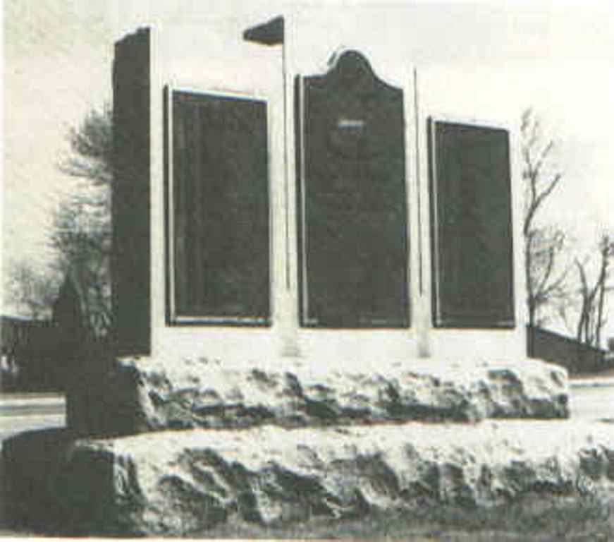 11) LOG COLLEGE MONUMENT - On the west side of York Road at the Tennent House. It was erected in 1927 by area Presbyteries to commemorate the site of the Log College building. Its bronze tablets enumerate the 64 colleges and universities that trace their roots to Log College. When the new York Road was put through, it ran to the back of the monument so that the back faces the road. It is hoped that it can be turned to face the road, during this 275th Anniversary celebration.
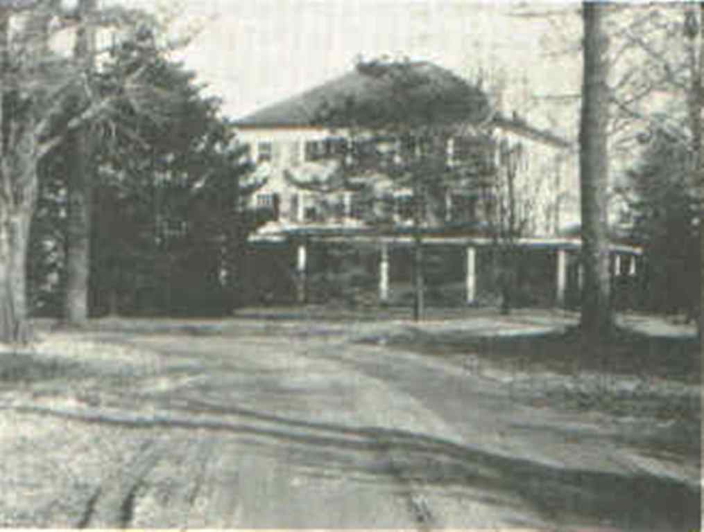 12) MAGOFFIN MANSION - Located far back from York Road and north of Street Road. Originally part of the Todd tract, the present building was built by Rev. John Magoffin. According to Mr. Robert Ramsey of Hartsville, during World War I, detachments of local recruits were trained by an Army officer named George Ross in the fields of this property which, at that time, extended to the corner of York Road and Street Road. Now the property of the Catholic church.
  13) CHRIST'S HOME - The entrance to Christ's Home is on the west side of York Road, about a quarter mile north of Street Road. A home for neglected and homeless children, it was started in Philadelphia by Dr. and Mrs. Albert Oetinger and Miss Katherina Krausbach on October 1, 1903. It was moved to Warminster in 1907 on ground purchased from the Ezra Carrell estate. The aged building at the entrance lane is known as the Todd House and could be one of the oldest houses in Warminster.
 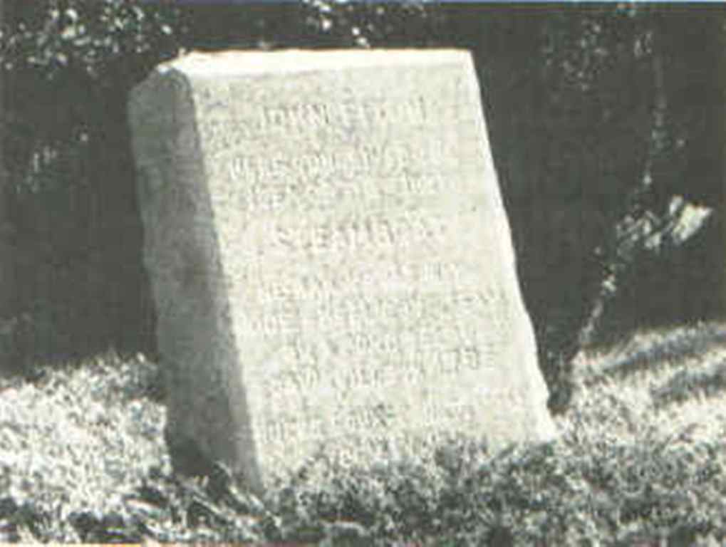 14) FITCH MONUMENT - Located on the northeast corner of Street Road and York Road on a small plot of ground donated for the purpose by the Habtoro Federal Savings and Loan Association. It marks the corner where John Fitch first conceived the idea for a steam driven vehicle.
 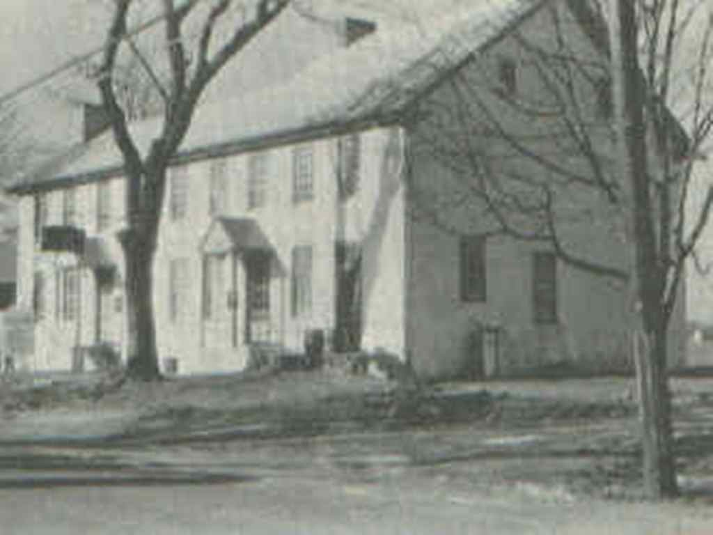 15) WARMINSTER HOTEL - Located on the west side of York Road, a couple of hundred yards south of Street Road. Until recent times, it was the only public house in Warminster. According to Gen. Davis' "History of Bucks County", one Thomas Lintner petitioned the court in 1730 for a license ". . .to keep a house of entertainment for man and horse." The property of 154 acres passed through a succession of owners until 1791, when Isaac Beans bought it and installed his son, Thomas, as proprietor. Thomas was a noted sports enthusiast and constructed a race track at the rear of the Hotel. Picture was made in 1940's. The drafted men in the area, during the War of 1812, assembled at Beans Tavern on Sunday, September 18, 1814 and marched, en masse, to Philadelphia.
  17) NOBLE HOUSE - Situated on the northwest corner of York Road and 5th Avenue. The original building probably consisted of the rear part, having a kitchen downstairs and one room upstairs. This part was built prior to 1734, according to Mr. Philip Reeves, a former owner, who had located an old deed on the property. The deed conveyed the house and 140 acres from Abel Noble to Job Noble. The Noble family is discussed in an earlier section of this book.
  19) JOHN HART HOUSE - Located east of Jacksonville opposite Ivyland's Gough Avenue at 1145 Charter Road in the newly-built Woodlands development. Typical of old Pennsylvania manor homes. In the double west gable is a date stone inscribed "1750 - J.E.H." (John and Eleanor Hart). John was the son of John Hart the elder who received a grant of about 1000 acres from Win. Penn in 1681. The Hart house is now the residence of Mr. Donald Brennan and Ms. Dorothy Rose-Brennan. More on the Hart family in the chapter "Warminster Pioneers.
 20) HOME OF JOHN HART III - Located on the south side of Kirk Road on what is now Navy property. The stone section was built in 1817 by a later John Hart, the frame part being added at a later date. This house is said to have been a station of the underground railroad, during the Civil War, while it was the property of Charles Kirk, where escaped Southern slaves were secreted until they could be taken on to the next "station" to freedom.
  21) MUNRO HOME - Located on Newtown Road, a short distance south of Bristol Road. The earliest deed records the sale of the property to James Vansant in February 1734. An existing deed shows the sale of the house and acreage from Richard Robb to R. Hart in April, 1842. Lately the property of the late Mrs. Virginia Munro, who sold the acreage to the Township. It is now the site of Munro Park.
 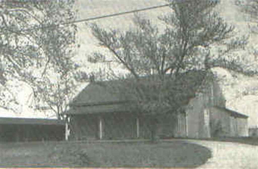 24) FRIENDS MEETING HOUSE - On the north side of Street Road, a short distance east of Jacksonville Road. Built in 1840, the building is now used by the congregation of the Assembly of God Church.
  25) CRAVEN HALL - Located on the southeast corner of Newtown Road and Street Road. Its original building dates to middle 1700's, while the newer part, facing Newtown Road was added about 1845. More on Craven Hall in the Johnsville part of the chapter "Communities of the Township."
  26) CRAVEN CEMETERY - Located on the border between the Fox Run Apartments and the athletic field of the old William Tennent High School. Sixty-four people are buried here, including at least five Revolutionary War soldiers, possibly from the Battle of Crooked Billet. The cemetery has been completely vandalized, during the past two decades, to the extent that not a single stone was left standing. Some stones were carted away; the remaining pieces are stored at Craven Hall.
  27) FITCH HOUSE - So called because John Fitch supposedly boarded here while living in Warminster. Owned by Charles Garrison at the time, it is located at the southward bend of Centennial Road, a few hundred yards from County Line. More on this house in the chapter on John Fitch.
  28) JOHN LONGSTRETH HOUSE - Located on Navy property near the end of Newtown Road. John was the son of Daniel Longstreth. The date on the datestone is somewhat obscure but seems to be 1787. Later this became the home of the Walker family.
  29) BARTHOLOMEW LONGSTRETH HOUSE - At the end of Schoolhouse Lane, on McGlynn Road. Built by Bartholomew Longstreth in 1713 or 1714 and has under-gone a series of additions and alterations since then. The books of the Hatboro Union Library were stored in the attic of this house during the Revolutionary War. More on the Longstreth family in the chapter on "Warminster Pioneers." A grandson of Bartholomew, Daniel Longstreth, had a boarding school at this home, about 1840's.
  (VALLEY ROAD BRIDGE; Formerly Mud Lane, Valley Road crosses the Little Neshaminy Creek at the north west corner of Warminster.)
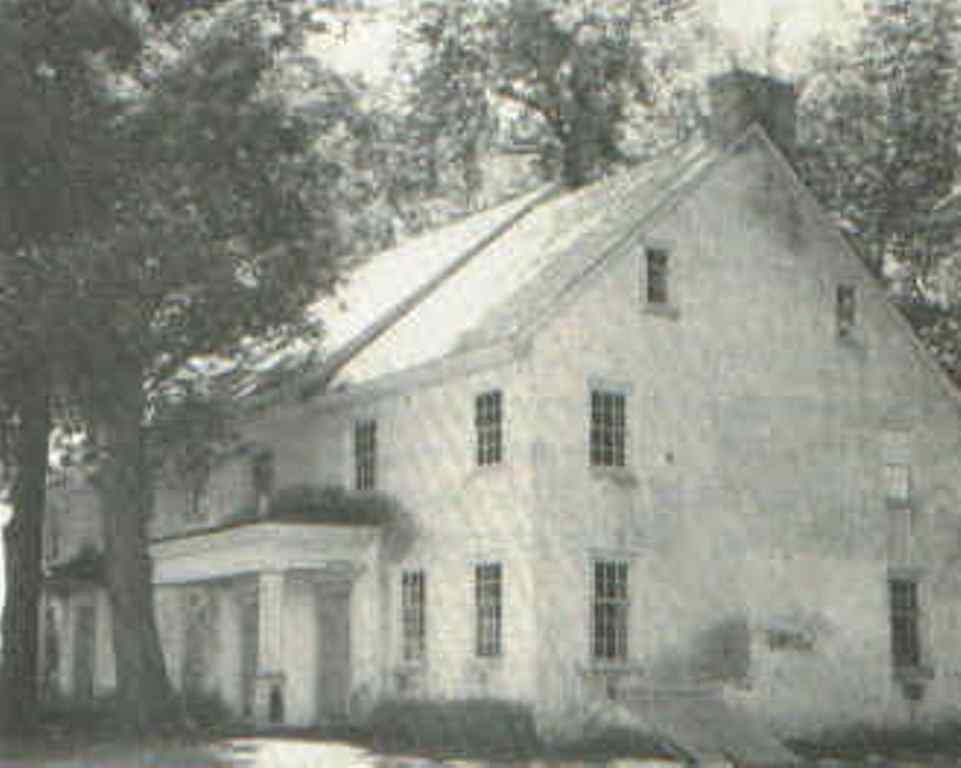 (JOHN DARRAH HOME; Another branch of one of Hartsville 's very old families. Demolished when Hartsville Park was built)
 (HOME OF MRS. MARY DOYLE; Next to N.A.D.C. parking lot on the north side of Street Road. Now a bank and office complex )
 (ISAAC BEANS HOME; Was located on what is now the Sired Road side of the N.A.D. C. parking lot.)
 (WALTON FARM; On the west side of Mearns Road just north of Ivyland Road. Demolished)
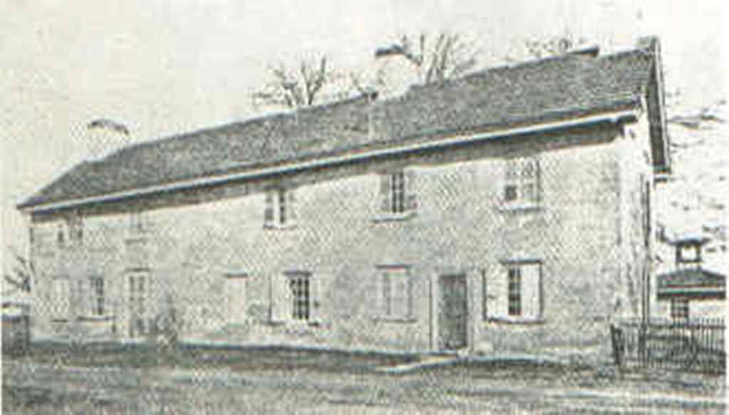 (FINNEY FARM; At the east end of Potter Street in Warminster Heights, Burned down in 1983)
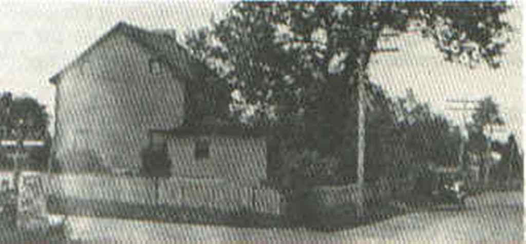 (CORNER OF YORK ROAD AND STREET ROAD; in about 1905 to 1910, Looking north on York Road at right)
Chairman, William DavisGOVERNMENTAL DEPARTMENTS
Vice Chairman, Christopher Staub
Secretary-Treasurer, Carl J. Messina
Members, Raymond Regan, Thomas Lisowski
AdministrationPublic Safety
Township Manager, LeRoy J. Fetterman
Finance Officer, Evelyn Preiksat
Bookkeeper, Joan Russell
Licenses and Inspection, Joseph Knox
Zoning Officer, Louis DiEva
Tax Collector, Kathleen Hodgkinson
Recreation Director, Karen Whitney
Library Director, Caroline Gallis
Public Works Director, William Hess
Township Engineer, Harry Barford
Solicitor, Richard Molish
Chief of Police, Elmer P. Clawges
Fire Marshal, Karl R. Lewis
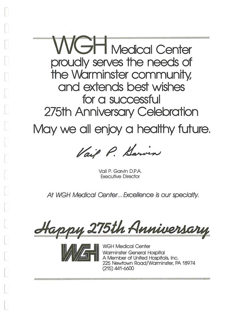
William Tennent High School: Centennial Road, south of Street RoadHOSPITAL: The Warminster General Hospital is a division of United Hospitals, Inc. and opened its doors on May 27, 1974, with 68 beds. The Hospital is now licensed for 200 beds and its staff of 250 doctors and 700 employees provide a full range of inpatient and outpatient services, all dedicated toward the goal of providing high quality health care to the community.
Log College Junior High: Norristown Road, north of Street Road
Willow Dale Elementary: Next to Log College
Everett McDonald Elementary: Street Road and Reeves Lane
Longstreth Elementary: Roberts and Marian Roads
Alta S. Leary Elementary: Henry Avenue at Victoria Road
Joseph Hart Elementary: Little Lane and Barness Drive
Archbishop Wood Parochial High School: York Road, north of Street Road
St. John Bosco Elementary: County Line, east of Jamison Street
Other schools in the Centennial Joint School System are located in Southampton:
Eugene Klinger Junior High: Second Street Pike, south of Bristol Road
William H. Davis Elementary: Maple Avenue and Hi View Drive
Frederick J. Stackpole Elementary: Strathman Drive and Mill Creek Road
Warminster Presbyterian: Madison Avenue and Nemoral StreetTRANSPORTATION: SEPTA's northern railroad terminal of the Hatboro-Warminster line is located on Park Avenue, south of Street Road. Due to the determined efforts of Albert W. Beyer, Township Supervisor at the time, this station was finished on May 22, 1970, the first station to be built by the old Reading Company since 1922. The line runs directly into center city Philadelphia. SEPTA bus line, Route 22 runs on York Road, Street Road, and Jacksonville Road, connecting at Willow Grove for points south into Philadelphia.
Nativity Of Our Lord R.C.: Street Road, east of York Road
Church Of The Nazarene: 866 West Bristol Road
Peace Chapel: Street Road and Norristown Road
Johnsville Reformed: Street Road and Newtown Road
Johnsville Assembly of God: 105 Street Road, (old Friends Meeting House)
Bible Baptist: Park Avenue and County Line
St. Andrews United Methodist: 999 York Road
St. John Bosco R.C.: 235 E. County Line Road
St. Philip's Reformed Episcopal: 220 Norristown Road
Warminster Heights Community Church: 6 Evans Avenue
Warminster Baptist: 709 Norristown Road
United Church Of Christ: 785 W. Street Road
Seventh Day Adventist: Greene Road and County Line Road
Kingdom Hall, Jehovah's Witnesses: 401 Madison Avenue
St. Mark's Orthodox: 124 Kipling Drive
West End on Norristown Road midway between Street Road and County Line.WARMINSTER VOLUNTEER AMBULANCE CORPS: Formed in 1960, due in part to the efforts of Albert W.Beyer. The first ambulance was a used vehicle that was housed at the firehouse. The Corps was incorporated in 1976 and now occupies a beautiful building on Evergreen Avenue, south of Nemoral Street with four ambulances and about 85 active personnel.
East End on Centennial Road between Street Road and County Line.
Harstville Fire Company #1 on the new York Road south of Bristol Road.

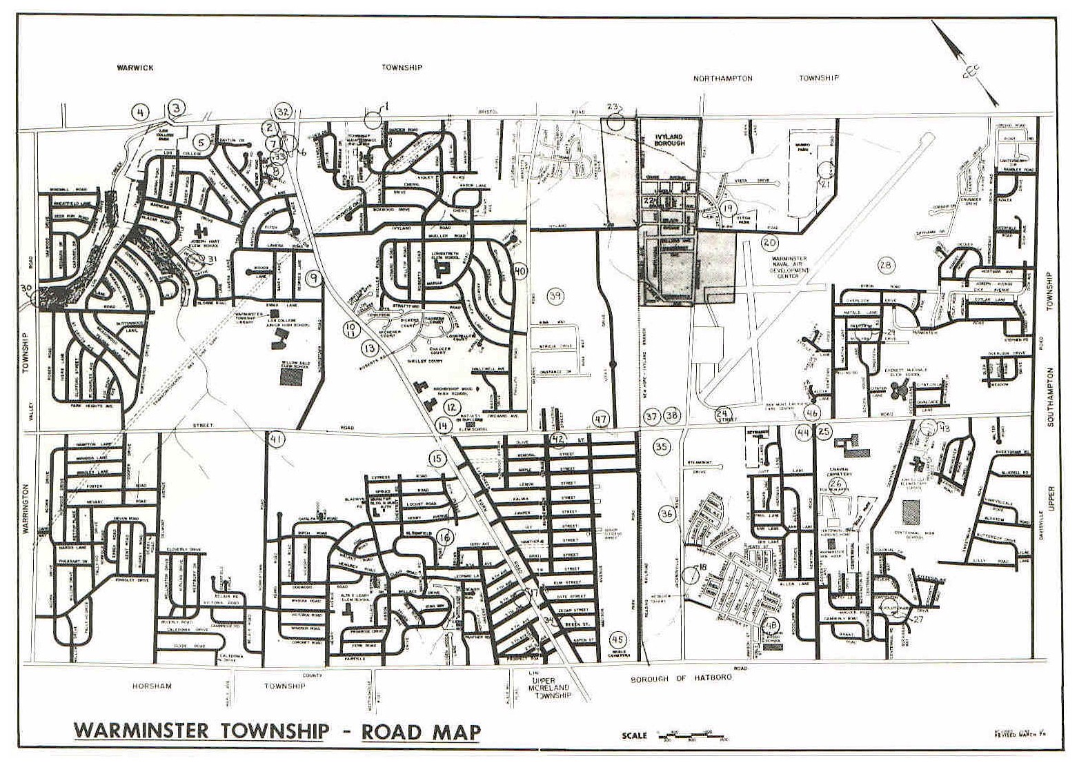 1986 Warminster Township Road Map
© 2024 Warminster Township.
All rights reserved.
Sign In
Powered by NuCitrus